Townscape Analysis & Urban Structure
Central City Section of Dobrich, Bulgaria
This insight study investigates the relationship between historic character, movement, landscape structure, and public realm within the central pedestrian areas of Dobrich. Through layered townscape analysis, the project identifies opportunities to strengthen identity, improve accessibility, and introduce sustainable landscape strategies while preserving the city’s cultural and architectural heritage.
Type: Insight Case Study
Focus: Townscape Analysis • Public Realm Strategy • Heritage & Landscape Integration
Year: 2022
01
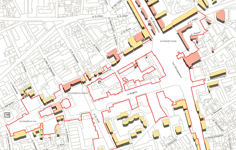
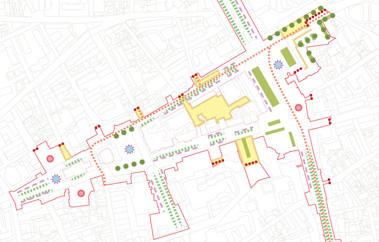
Urban Context
Dobrich’s urban structure reflects layers of cultural, historic, and landscape identity shaped by centuries of social and political change.
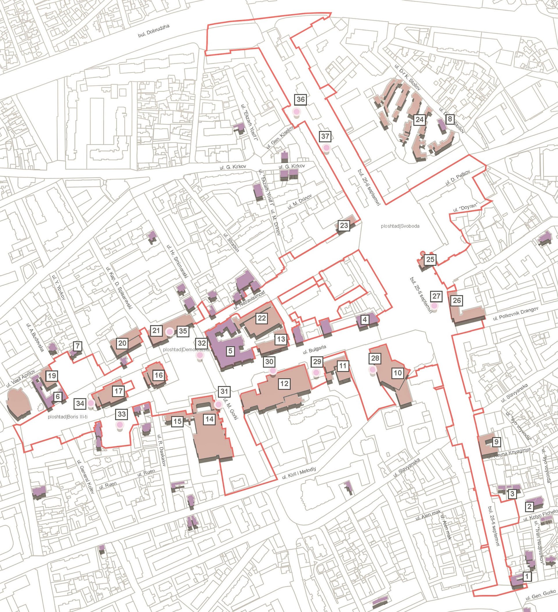
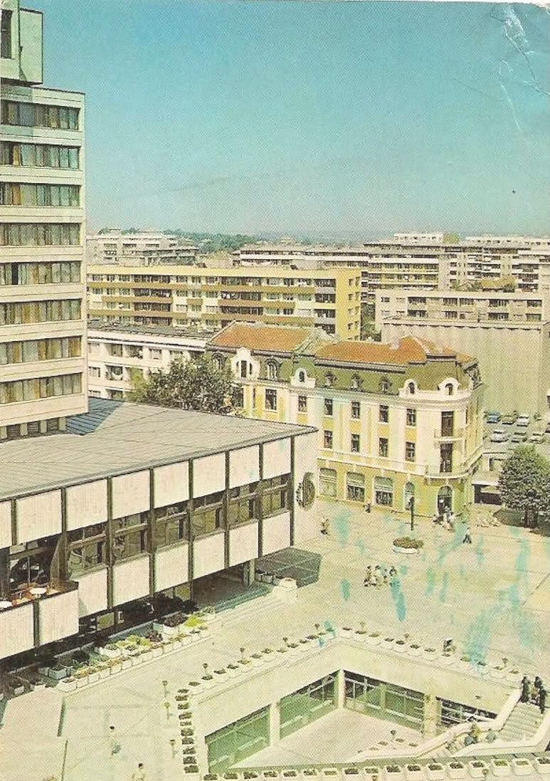
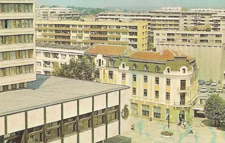
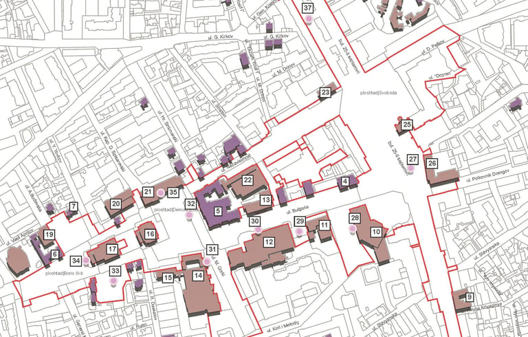
Located in north-eastern Bulgaria, the city developed as a regional civic and economic centre, defined by significant public buildings, pedestrian spaces, and green infrastructure. The study focused on the central city section, where historic architecture, public squares, and landscape elements combine to form a distinctive townscape character.
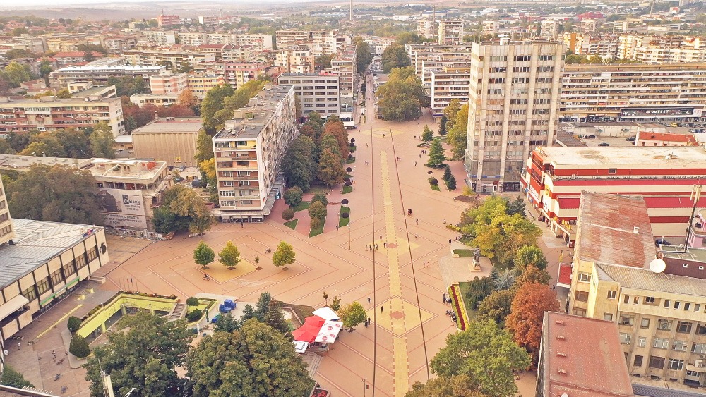
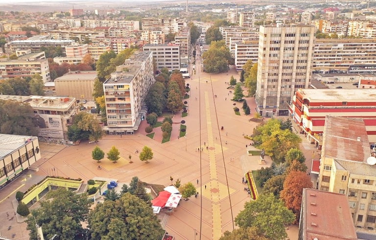
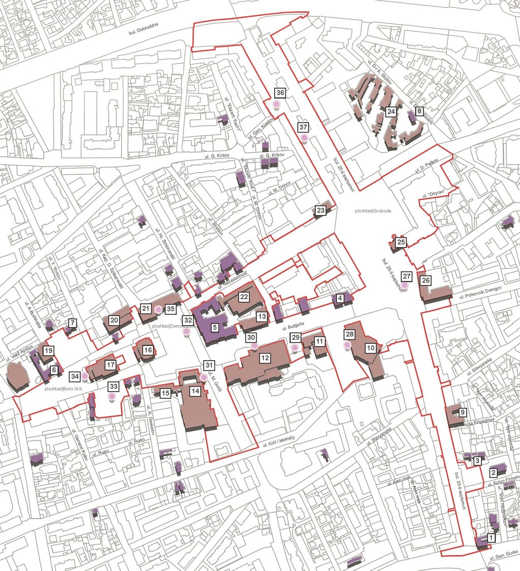
The study examined the relationship between built form, public realm, and landscape structure across the central city area.
Key routes, civic landmarks, commercial corridors, and green infrastructure were mapped to understand how the townscape functions spatially and visually. Particular attention was given to:
heritage and periodic buildings
pedestrian movement and connectivity
existing vegetation and public space
visual consistency across commercial frontages
the relationship between streets, squares, and landmarks
02
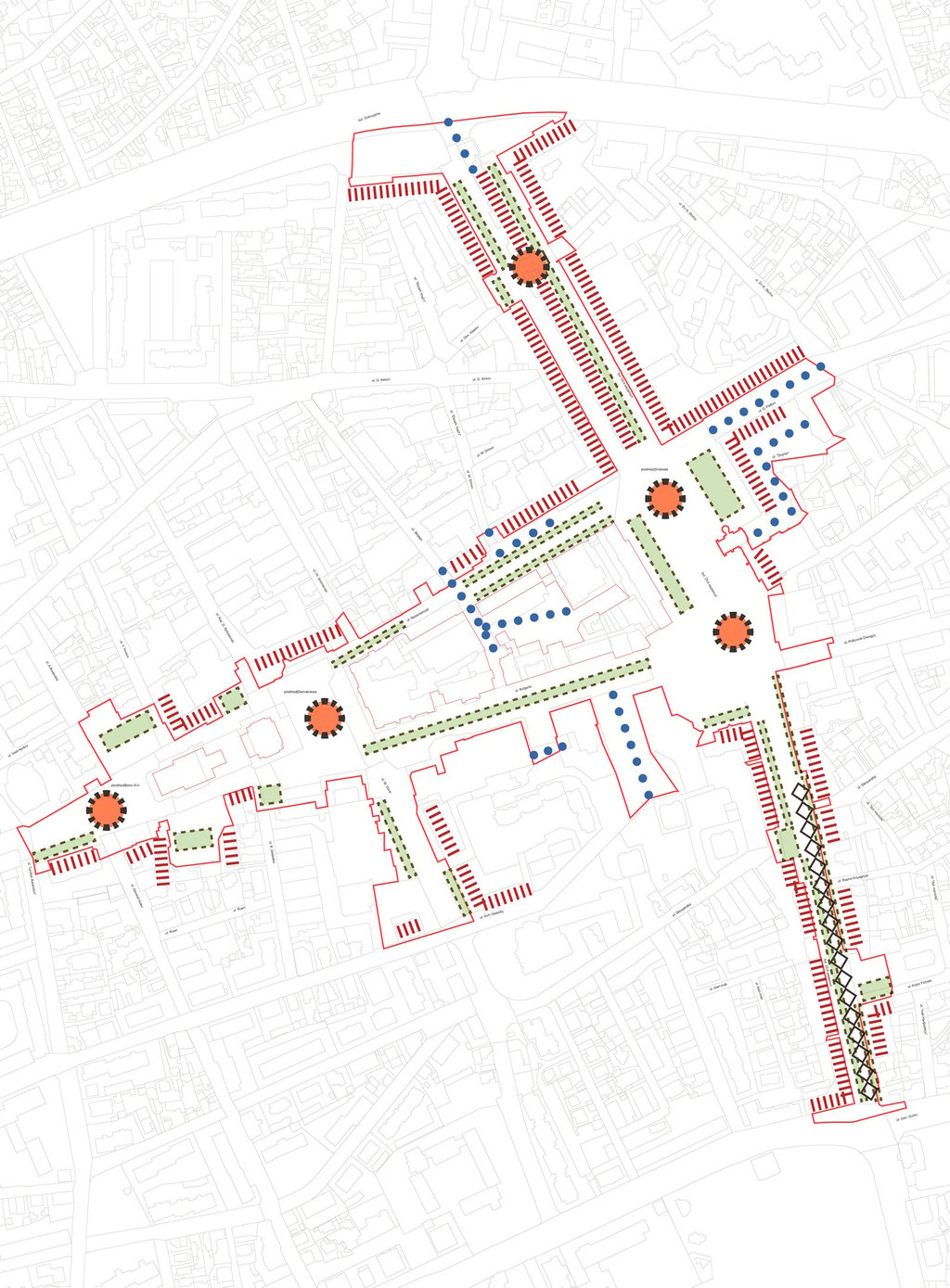
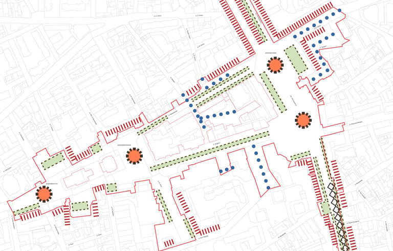
Townscape Analysis
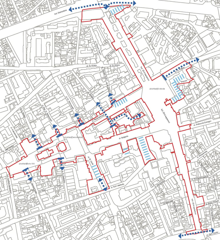
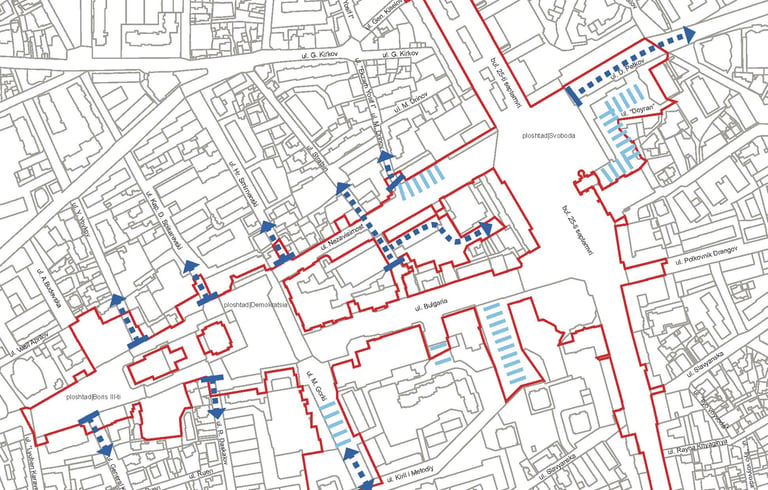
This analytical framework established a clear understanding of both the character and pressures shaping the city centre.
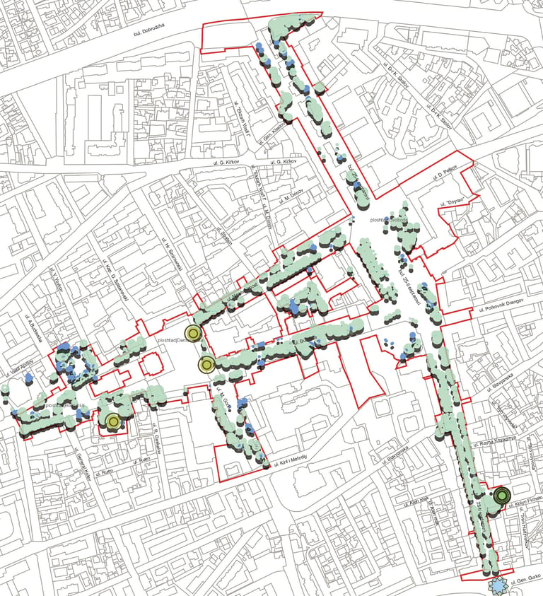
The analysis identified several opportunities to reinforce the identity and usability of the public realm while addressing fragmentation and environmental pressures.
Key opportunities included:
strengthening pedestrian priority
improving spatial coherence
expanding green infrastructure
enhancing civic spaces and heritage settings
integrating sustainable drainage and planting
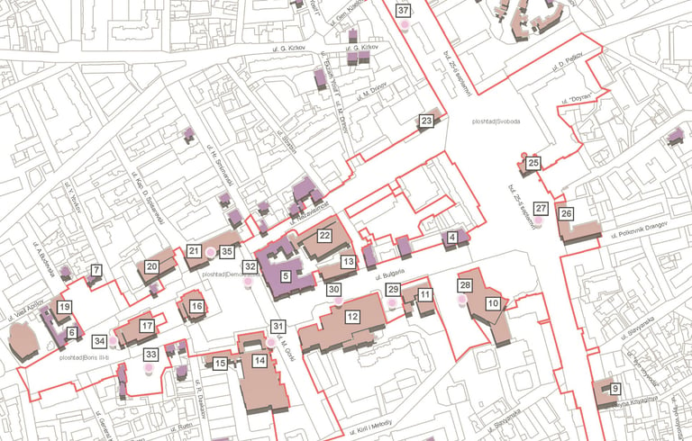
A number of constraints were also identified, including fragmented planting areas, excessive vehicular intrusion, inconsistent commercial frontages, and deteriorated paving conditions.
Key Insight
Townscape analysis is not only about understanding buildings and movement - it is about identifying how landscape, heritage, infrastructure, and public life interact to shape the identity of a place.
This study demonstrates how detailed spatial analysis can inform regeneration strategies that are environmentally responsive, historically grounded, and socially inclusive.


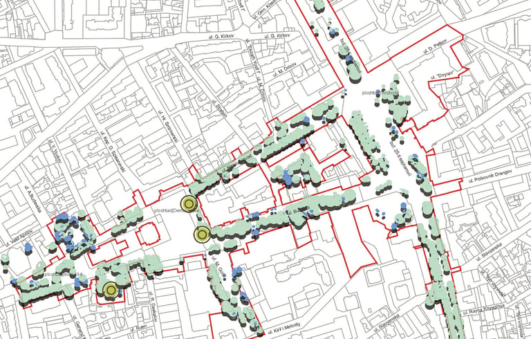
03
Constraints & Opportunities
04
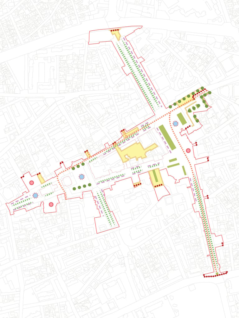
Landscape Strategy
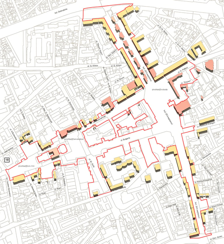
The proposed strategy focused on revitalising the city centre through a landscape-led approach that balances heritage, accessibility, and environmental resilience. The framework introduced:
enhanced pedestrian areas and movement routes
rain gardens and expanded planting
unified material and street furniture palettes
improved public realm connectivity
Existing character-defining materials and landscape elements were retained wherever possible, supporting a sustainable and context-responsive approach to regeneration.